|
We hear a lot about it: the integration of green spaces could change our cities from dead concrete caverns to lush green paradises, with reduced pollution, local food production, and many social and health benefits. But how to achieve this in specific cities is less clear: where exactly do these opportunities lie, what is possible, how do we communicate it, and where do we start? This project answers exactly those questions and helps provide a guideline for cities all around the world.
The Challenge:
Usually, the desire to "green" our cities is driven by a collection of small bottom-up initiatives. While these can be effective at times, without the backing of policy and project development they'll stay just that: small scale and locally confined. Some of the largest positive benefits of including natural areas occur only on a neighborhood or city scale. Ultimately, when only small, local projects are realized, the major benefits of a green city will not materialize.
Some cities have central policy guidelines for urban "greening," but what that exactly means is often not clear. Who does what, and where can which intervention provide the most positive benefits? Do we choose green roofs, green facades and walls, permeable pavements, or just an apple tree here and there? Where does urban agriculture fit in?
It's time to do something about that.
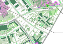
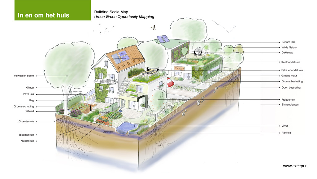
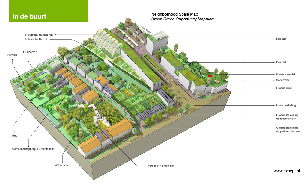
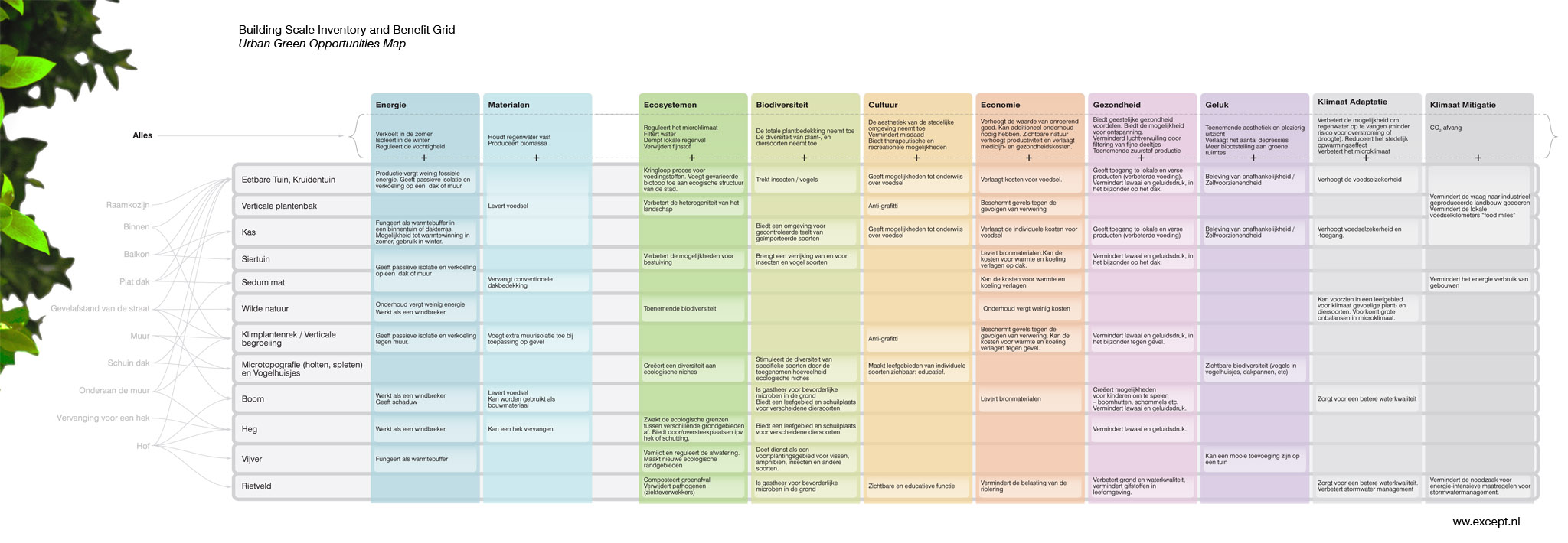
With a multidisciplinary team of ecologists, architects, urbanists, and local policy makers we made a map of opportunities for beneficial green interventions for the Dutch city of Roosendaal. We analyzed the city on three scales: building, neighborhood, and the entire inner city. Another scale can also be added to connect these urban initiatives with regional greenspace plans.
For each scale, we identified all possible green interventions, from house plants to interconnected rooftop gardens. We created a comprehensive chart that shows what kind of intervention can be applied in each type of location, and what its specific benefits will be. Finally, these natural elements were placed on maps of the city at the three different scales to show where many opportunities exist. The provided document shows this part of the process.
The next step is to find stakeholders for each intervention, using the document to show the beneficial aspects of each section. This way city council, communities and enterprises can actively start to green their city together.
Communication
This opportunity scan shows the importance of connecting natural spaces in our cities. One of its most important functions is to provide a clear and inspirational guideline to city inhabitants for what they can actually do. From residents to small business owners all the way to city government and large project developers, the map lays out a |