|
| |

In this project I worked together with Isaac Strackbein to design an urban intervention in one of the old Lilong social housing districts in Shanghai, China. We visited Hong Kong and Shanghai and collaborated with ten students from Tong Gi university in Shanghai and Hong Kong university to generate a solution for this site. The followin project is Isaac and my proposal for this unique place in the heart of the new down town. We propose a project that integrates several solutions to pressing problems of Shanghai, among which are pollution, traffic, replacement housing, decreasing agricultural land and runaway development. A master plan places core buildings in Shanghai’s typical Lilong social housing districts which are on the brink of demolition throughout the city, and connects them through channel systems that are accompanied with bicycle and pedestrians thoroughfares. The cores contain mixed use urban centers activated by a program of market places, cultural facilities, public gardens, retail, commercial, residential and large scale urban agriculture. Some Lilong districts are sacrificed to create new viable conditions for others and the diagram of these Lilongs are turned inside out. The farms clean water and air while also generating energy and food and lay a foundation for a sustainable future. Extensive research in Vertical Farms and Farming techiques, the city fabric and the social situation on the site made us propose this project which focuses less on the aesthetic experience than on the programmatic, social and envrionmental response of the site.
Below are various images of the project, but you can also download the presentation posters in PDf format (Poster 1, Poster 2), and the slide presentation in PDf format (40mb) .
|
|
|
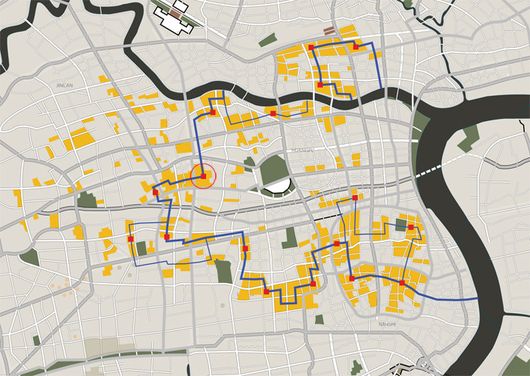
A map of the city, showing the locations of the existing lilong districts we wish to preserve. The blue lines corresponds with the route of the channels that are planned through the city, and the red squares the location of the core developments.
 |
| A diagram showing the vertical farm cores in relation to the neighboring districts, their walking distance and the path of the channels and green ways that track through the center of the existing sites, generating new open spaces and ensuring pedestrian and bicycle thoroughfares, undistrubed by motor traffic. |
| |
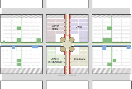 |
| This diagram shows the way this particular core opens up the center of the traidtionally enclosed Lilong district, and reuses its structure for various purposes, such as cultural, institutional and residential. The cores consists of urban agriculture in the form of vertical farms mostly, augmented with schools, libraries, restaurants, residential and office units. |
| |
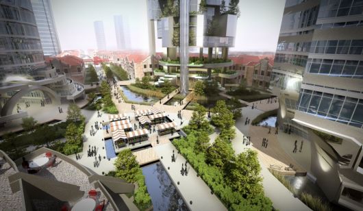 |
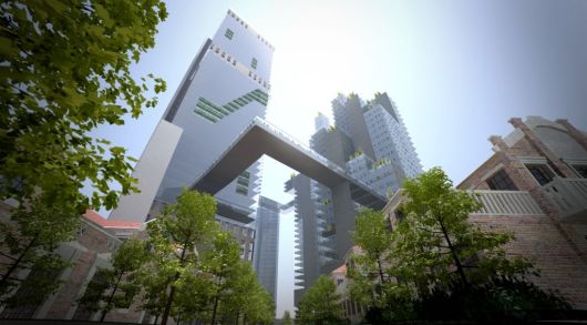
The central area in between four vertical farm towers that each function as a gateway to their respective sections on the site, such as urban markets, a civic and cultural district, residential and office areas. In the center is a place where individuals can particupate in a street market where they sell produce generated in their communal garden areas in one of the towers.
Click for a larger version.
|
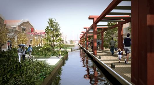 |
| Channel area in preserved Lilong block showing pedestrian and bicycle routes. Click for a larger version. |
| |
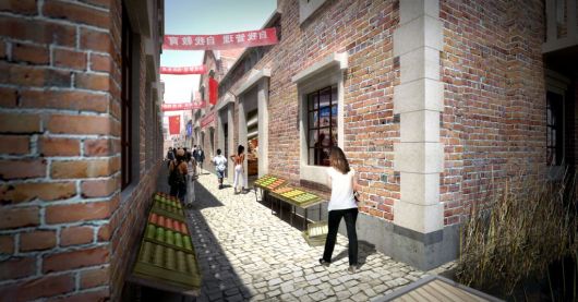 |
| This visualization shows the urban markets taking place within the original lilong social housing blocks. |
| |
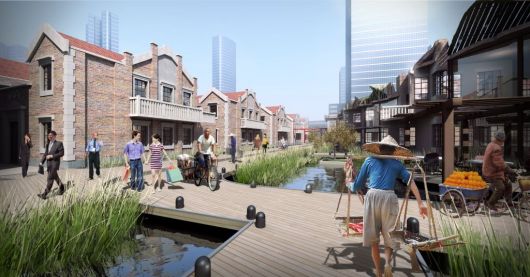 |
| The northern path on the site is showing the Lilong markets on the left, partially ruined Lilongs converted to eateries, teahouses and restaurants on the right, and the predestrian and bicycle thoroughfare following the channel and green path in the center. |
| |
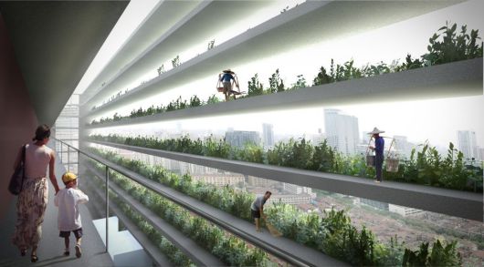 |
| A concept for medium scale urban agriculture or vertical farming in combination with standard housing typologies, where food production and living envrionments are once more reconnected, and the plant life providing pleasant shading for the southern facades of the residential apartment blocks. |
| |
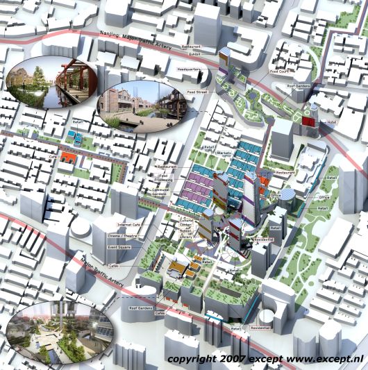 |
| Isometric Diagram showing the layout of the proposed area, its uses and vertical massing, secions through the vertical farm towers and the path of the channels and green ways on the site. Click for a larger version. |
| |
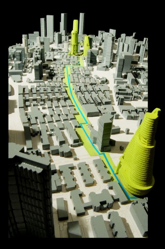 |
| Model photograph |
| |
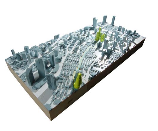 |
| Model photograph |
| |
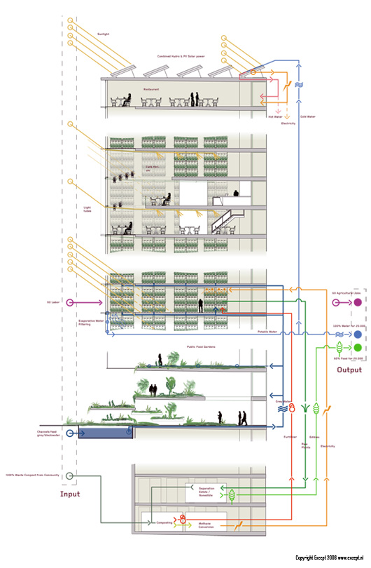 |
| Vertical Farm Technical section and diagram |
| |
 |
| Left presentation poster (download in PDF, 10mb) |
| |
 |
| Middle presentation poster (download in PDF 12mb ) |
| |
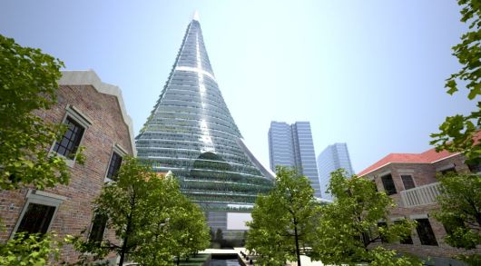 |
| A tower concept that responds to the path of the sun to maximize solar exposure of the plants. |
| |
 |
| Another tower concept |
|
|