|
|
|
|
|
|
|
|
|
|
|
| |
|
|
|
|
 |
| |
| |
Be sure to view the full size maps by clicking on them.
Below you'll find some examples of system maps and diagrams. System maps are a part of our sustainability development method, Symbiosis in Design. They are of vital importance when analyzing and understanding complex questions and formulating smart answers.
We generally discern between three types of system maps: spatial, temporal and contextual.
When mapped together, an overview of a dynamic system can be created, for instance of a production chain, a design, a policy intervention or urban development. Some maps are highly specific for a certain subject, for instance CO2 reductions or energy flows, and others are more integrated in nature. |
|
|
|
| |
| |
| |
Visual strategy
There are many ways to make system maps. Whichever way is chosen, great care needs to be taken to match the data acquisition, often considerable, with the right visual representation. The example maps show a variety of ways to express these system maps and diagrams, from Sankey diagram style flowcharts to intricate contextual system maps of whole industrial sectors.
Some of these maps were used for internal research exclusively, while others have been designed for public
communication.
These diagrams (like most of Except's work) is licensed under a Creative Commons Attribution-NonCommercial-ShareAlike 3.0 Unported License.
 |
|
|
|
|
| |
|
 |
|
| |
|
|
|
|
|
 |
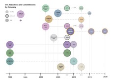 |
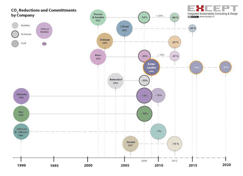
An example of system mapping in a corporate social responsibility trajectory (CSR), where a single parameter for CSR performance is measured against those of competing parties.
From the Cosmetics CSR project.
|
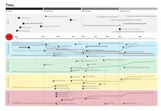 |
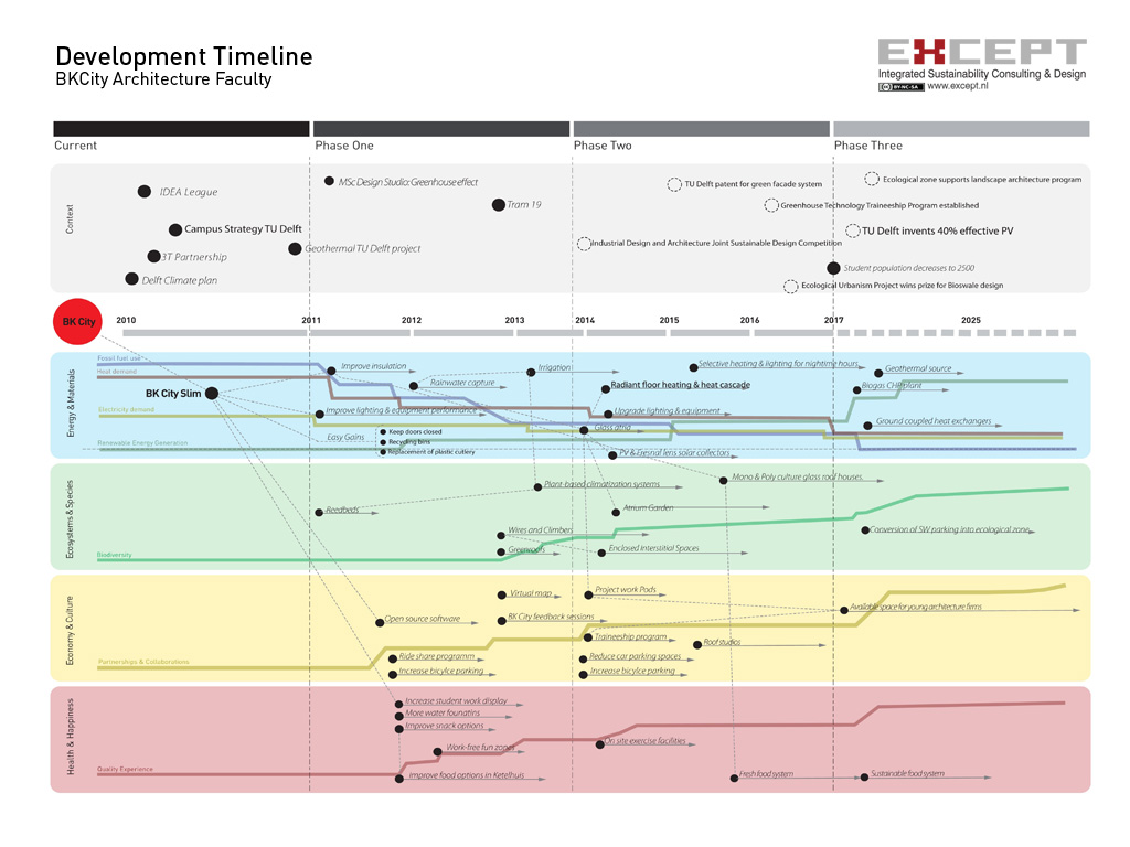
This is a comprehensive temporal system map showing the development of a monumental educational building towards self-sufficiency in several phases.
From the BKCity Sustainable Renovation project.
|
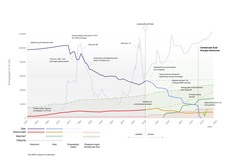 |
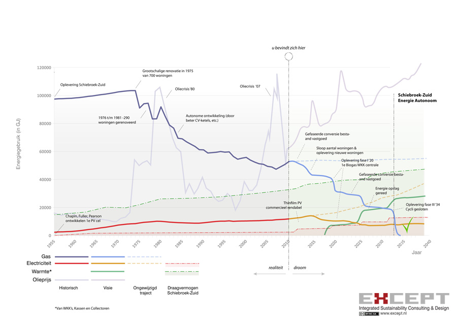
This maps shows the temporal development of the energy sources for an existing urban neighborhood in the process of conversion towards sustainable operation.
From the Sustainable Schiebroek-Zuid project.
|
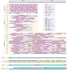 |
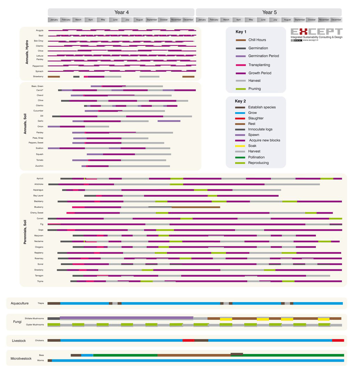
A very different kind of time-map, this diagram shows many parameters of plant growth in a polyculture greenhouse system for a single year.
From the PolyDome Polycultre Greenhouse Agriculture System project.
|
|
|
|
|
|
|
|
|
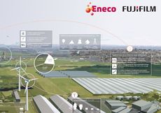 |
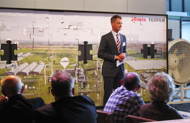
This system map was made for Eneco Wind, showcasing the many benefits of the Fujifilm wind energy park for the local community and the environment.
The system map was used in the form of a giant puzzle on the wall at the opening of the FujiFilm windpark, allowing all visitors to participate in making the system complete.
|
|
 |
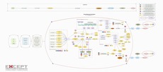
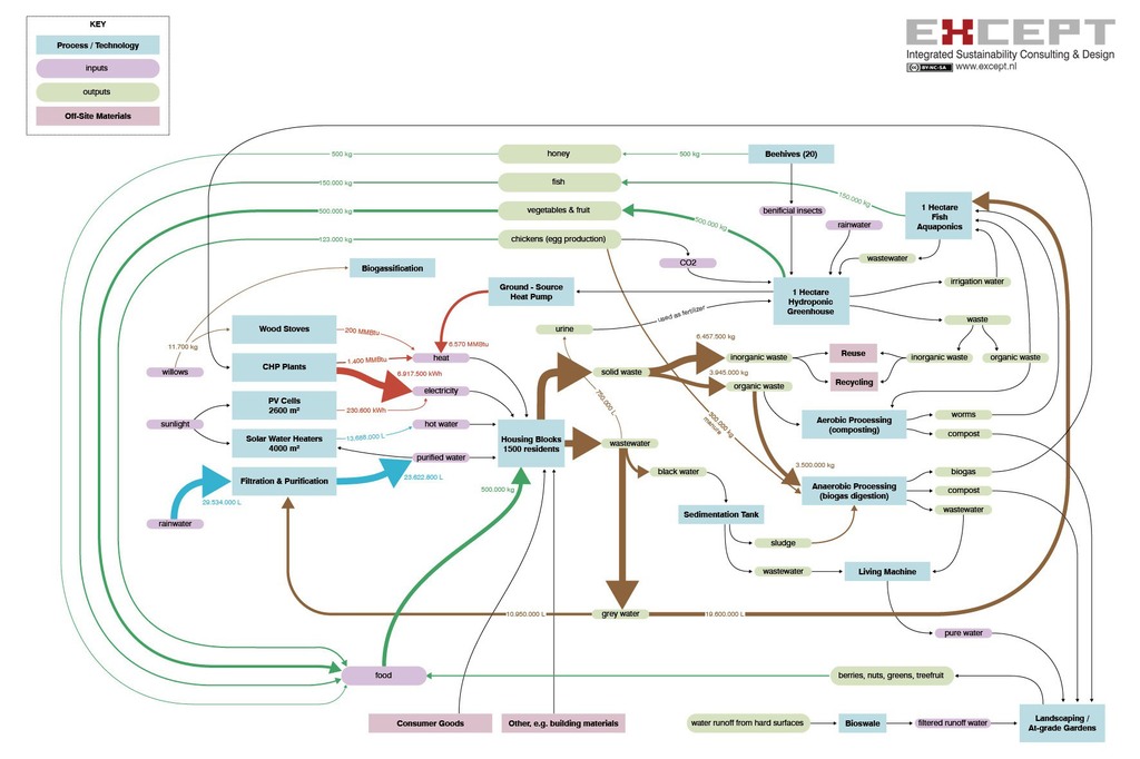
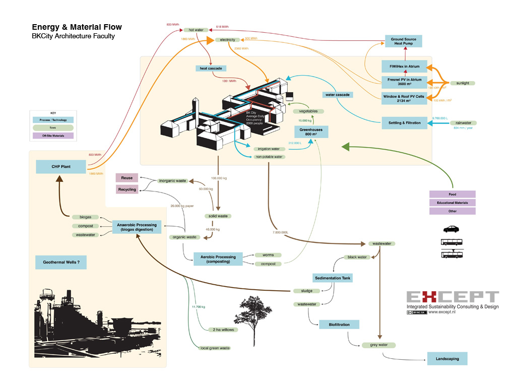
An example of an energy & material flow context map, showing how all elements of a neighborhood are connected in a dynamic, self sufficient system.
From the Sustainable Schiebroek-Zuid project.
|
|
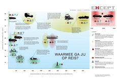 |
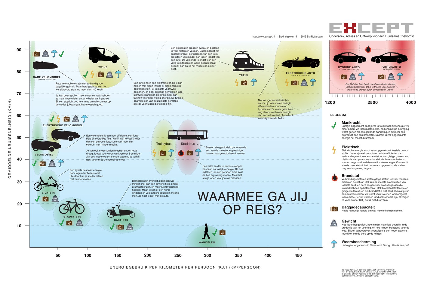
A playful context map showing common transportation types and their energy use per km. PDF here for editing.
From the Velomobile Integration project.
|
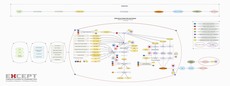 |
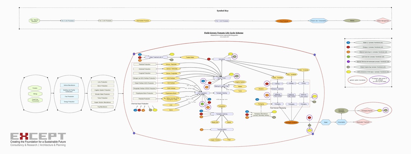
A map showing the production life cycle of tomatoes in great detail. This map was meant for print production, and can be better viewed in PDF form here.
From the Food Impact Mapping project.
|
 |
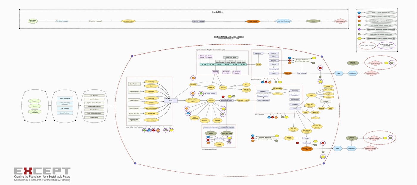
Similar as the tomato map above, this is a life-cycle map of the production chain, but for Beef and Dairy. PDF here.
From the Food Impact Mapping project.
|
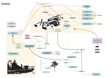 |
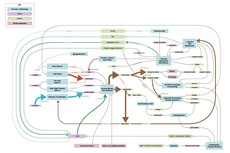
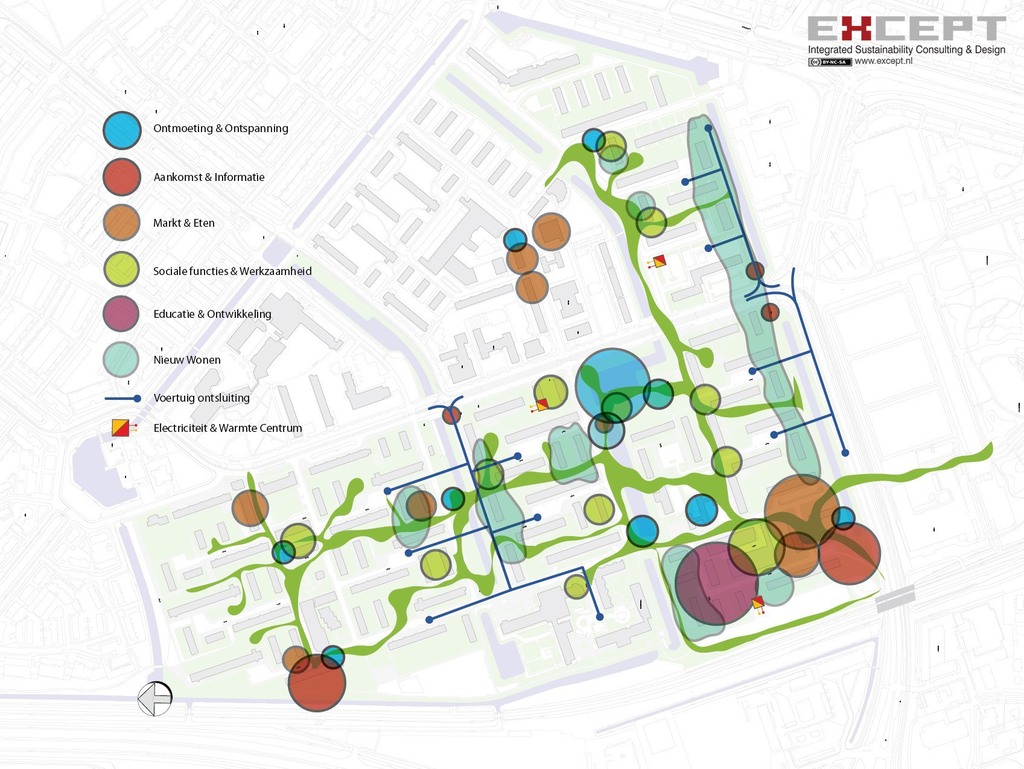
A neighborhood-level context map for the closing of energy and material loops of a university campus.
From the BKCity Sustainable Renovation project.
|
 |
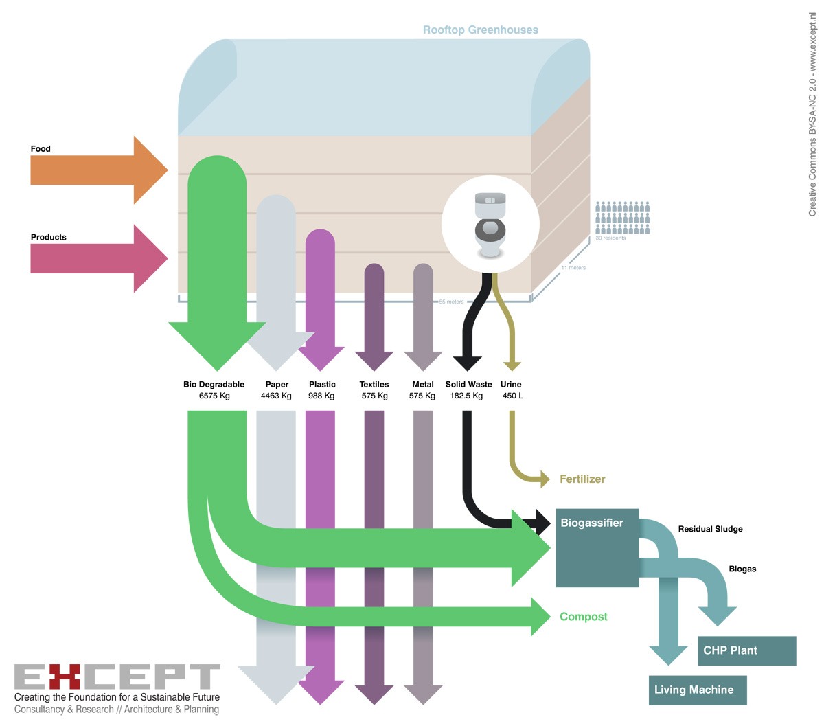
A very simple context map showing the waste flows of a single object, in this case, an apartment building.
From the Sustainable Schiebroek-Zuid project.
|
|
|
|
|
All contents Creative Commons BY-SA-NC Except Integrated Sustainability, 2011
|


